 |
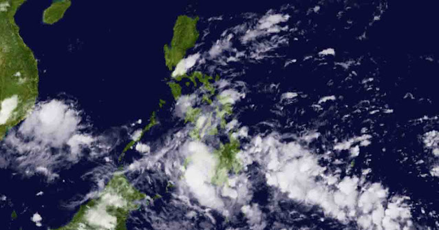
| PAGASA reported Wednesday that an LPA had formed off General Santos City and embedded along ITCZ, which could affect Eastern Visayas. Photo: Himawari-8 |
The Philippine Atmospheric, Geophysical and Astronomical Services Administration (PAGASA) reported on Wednesday, November 16, 2022, that a low-pressure area (LPA) had formed over the waters off General Santos City.
According to PAGASA's most recent bulletin, the LPA was last seen 445 kilometers east of General Santos City at 3 p.m. and is embedded along the Intertropical Convergence Zone (ITCZ), which is still affecting Mindanao.
Due to the ITCZ and LPA, cloudy skies with scattered rain showers and thunderstorms are expected over Eastern Visayas and Mindanao.
Meanwhile, the shear line is expected to continue to affect Eastern Luzon, bringing cloudy skies with scattered rain showers and thunderstorms to the Bicol Region and the provinces of Aurora, Quezon, and Isabela.
The skies in Metro Manila and the rest of the country are likely to be partly cloudy to cloudy, with isolated rain showers or thunderstorms scattered due to localized storms.
Winds from moderate to strong may prevail over the eastern part of the country, accompanied by moderate to rough seas. Meanwhile, light to moderate winds will blow across the rest of the country, with slight to moderate coastal waters.
